

Drones vs Cameras for Aerial Photography: 2026 Guide
Table of Contents
- Aerial Photography at a Glance: Drones vs. Cameras Compared
- Drone Photography vs Handheld Camera Quality: Sensor Size and Image Output
- FAA Part 107 Requirements Every Aerial Photographer Must Know
- Drone Flight Restrictions and Privacy Laws That Affect Your Shots
- Technical Skill Curve, Portability, and Flight Time Realities
- Insurance, Liability, and Hidden Costs of Aerial Photography
- Which Setup Should You Choose? A Practical Decision Framework
- Conclusion
Last Updated: August 14, 2026
Aerial Photography at a Glance: Drones vs. Cameras Compared
Drones vs cameras for aerial photography is one of the most consequential equipment decisions a photographer faces today. This guide addresses the real trade-offs: regulatory burden, hidden costs, skill requirements, and ethical questions most buying guides ignore.
The core tension is this: drones offer perspectives impossible to achieve with handheld cameras, but they introduce operational complexity, legal responsibility, and financial risk that ground-based photography does not. Neither option is universally better, the question is which matches your project, budget, and tolerance for regulatory paperwork.
| Factor | Consumer Drone | Camera on Drone Platform | Ground-Based Camera |
|---|---|---|---|
| Sensor Size | 1/2" to 4/3" CMOS | Full-frame to 150MP medium format | Full-frame and above |
| Typical Flight Time | 30-43 minutes | 15-25 minutes (heavier payload) | N/A |
| FAA Certification | Part 107 required for commercial use | Part 107 required | Not required |
| Portability | High (folds flat) | Low (requires separate platform) | Moderate |
| Entry Cost | Moderate | Very high | Moderate to high |
| Best For | Aerial video, landscapes, real estate | Mapping, surveying, cinematic production | Portraits, events, controlled environments |
Drone Photography vs Handheld Camera Quality: Sensor Size and Image Output
Sensor size is where the gap between drone and handheld camera quality becomes most visible, and it's closing rapidly.
Consumer drones like the DJI Mavic 3 Pro use a 4/3 CMOS sensor with Hasselblad color science, producing professional-grade output for real estate, landscape, and event coverage. The Autel Robotics EVO Lite+ steps up to a 1-inch CMOS sensor capable of 50MP stills and 6K video with adjustable aperture from f/2.8 to f/11.
The gap opens when mounting a dedicated camera body on a heavy-lift drone. The Canon EOS R5, with its 45MP full-frame sensor and 8K raw video, produces images no integrated drone camera currently matches for resolution and depth of field control. The Phase One iXM-RS150F packs a 150MP backside-illuminated sensor designed for large-scale mapping and surveying.
For general aerial photography, a premium consumer drone delivers 85% of the results at a fraction of the complexity. For cinematic production, scientific mapping, or work where pixel density is critical, a mounted full-frame or medium-format system justifies the added weight and cost.
Dynamic Range and Low-Light Performance
Full-frame sensors like the Canon EOS R5 handle high ISO sensitivity with significantly less noise, which matters for golden-hour and dusk shoots. The Phase One iXM-RS150F's backside-illuminated architecture improves light capture efficiency, performing well in variable lighting conditions common to large-area mapping.
If your aerial photography work happens in controlled daylight, a consumer drone's sensor is sufficient. For dawn, dusk, or overcast conditions where dynamic range matters, a larger sensor produces noticeably better results.
RAW Format, Bitrate, and Post-Processing Workflows
Most serious aerial photographers shoot RAW format to preserve full sensor data for color grading and exposure correction. The DJI Mavic 3 Pro captures RAW stills and high-bitrate video. The Autel EVO Lite+ similarly supports RAW capture with 6K video output. Mounted cameras like the Canon EOS R5 offer 8K RAW video and full post-processing flexibility.
Budget for fast storage media and capable editing hardware, high-bitrate aerial footage generates files requiring substantial infrastructure.
FAA Part 107 Requirements Every Aerial Photographer Must Know
FAA Part 107 requirements govern all commercial drone operations in the United States. According to FAA's official Part 107 overview, any person operating a drone for commercial purposes must hold a Remote Pilot Certificate issued by the FAA.
Part 107 is not optional. Flying commercially without certification exposes you to civil penalties and potential criminal liability. The FAA defines "commercial" broadly: if you receive any compensation for work involving drone flight, Part 107 applies.
The certification process requires passing a 60-question aeronautical knowledge test at an FAA-approved testing center, covering airspace classification, weather, emergency procedures, and drone regulations.
Registration, Certification, and Visual Line of Sight Rules
Every drone weighing more than 0.55 pounds must be registered with the FAA through the FAA DroneZone registration portal, and the registration number must be displayed on the aircraft.
Visual line of sight (VLOS) is one of the most operationally significant Part 107 rules. Remote pilots must maintain unaided visual contact with their drone at all times during flight. Beyond-visual-line-of-sight operations require a specific FAA waiver, rarely granted for routine photography work.
Other core Part 107 operational rules include:
- Maximum altitude of 400 feet above ground level in uncontrolled airspace
- No sustained flight over people unless they are directly participating in the operation, under a covered structure, or inside a stationary vehicle that provides reasonable protection from a falling drone. Operations over moving vehicles are also restricted.
- Daylight operations only, unless you hold a night waiver
- Maximum airspeed of 100 mph
- No flight from a moving vehicle unless in a sparsely populated area
Ground-based photographers face none of these regulatory requirements.
Drone Flight Restrictions and Privacy Laws That Affect Your Shots
Controlled airspace around airports requires authorization through the FAA's LAANC (Low Altitude Authorization and Notification Capability) system before flight. Many urban areas fall within Class B, C, or D airspace where blanket restrictions apply. National parks, military installations, stadiums during events, and critical infrastructure sites are permanently or temporarily restricted. The FAA's B4UFLY app provides a starting point for checking restrictions, but pilots should cross-reference with FAA UAS Data on airspace restrictions before every mission.
Privacy law adds another layer of complexity. Several states have enacted specific drone privacy statutes that restrict photography of private property, individuals, or agricultural operations without consent. Violating these laws creates civil liability exposure that standard homeowner's policies do not cover.
Technical Skill Curve, Portability, and Flight Time Realities
Operating a drone safely requires understanding flight controller behavior, wind compensation, gimbal stabilization, and battery management simultaneously. A ground-based photographer can focus entirely on composition and light. A drone pilot is also a remote pilot, responsible for airspace awareness, obstacle avoidance, and emergency procedures.
Portability is a genuine advantage for consumer drones. The DJI Mavic 3 Pro folds flat and fits in a small backpack. Portability decreases as payload capacity increases: mounting a Canon EOS R5 requires a significantly larger aircraft that does not fold into a daypack.
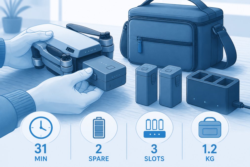
Flight time is the most underappreciated operational constraint. The DJI Mavic 3 Pro achieves up to 43 minutes of maximum flight time under ideal conditions. Real-world flight times in wind are shorter. A typical productive shooting window is 20-30 minutes per battery.
- A standard professional shoot requires 3-5 battery cycles minimum
- Charging a drone battery takes 60-90 minutes
- Parallel charging hubs reduce downtime but add equipment cost
- Cold weather significantly reduces battery capacity
Battery Management and Flight Controller Basics
Battery management is safety-critical. Lithium polymer batteries degrade with each charge cycle and can fail catastrophically if over-discharged or stored improperly. Most flight controllers include low-battery warnings and automatic return-to-home functions, but these require correct configuration.
Flight controllers also manage gimbal stabilization, which produces the smooth footage associated with professional aerial photography. Understanding gimbal calibration, stabilization parameters, and controller telemetry separates consistent results from luck.
Insurance, Liability, and Hidden Costs of Aerial Photography
Insurance is where the real cost comparison between drones and ground-based photography diverges sharply.
Commercial drone operators need dedicated aviation liability insurance. Standard business liability policies and homeowner's policies explicitly exclude aircraft, including drones. Aviation liability coverage typically includes hull coverage for the drone and third-party liability coverage for property damage or bodily injury. This represents a recurring annual expense that ground-based photographers do not face.
Hidden costs of drone aerial photography:
- FAA knowledge test fees and renewal requirements
- LAANC authorization tools and airspace management subscriptions
- Firmware update monitoring and compliance management
- Replacement batteries (typically needed every 12-18 months of regular use)
- Crash repair or replacement costs
- Ground crew costs for complex shoots requiring a visual observer
According to AOPA's drone insurance guidance, the liability exposure from a commercial drone incident can easily exceed the cost of the drone itself many times over.
Which Setup Should You Choose? A Practical Decision Framework
Aerial photography is not a single use case. The right tool depends on what you're capturing, how often you fly, and what operational constraints you can absorb.
Choose a consumer drone if:
- Your primary need is aerial video and stills for real estate, events, or landscape work
- You want a self-contained system without a separate camera body
- Portability and ease of deployment matter more than absolute image quality
- You're willing to invest time in Part 107 certification and ongoing regulatory compliance
Choose a camera mounted on a drone platform if:
- Your project requires full-frame image quality, specific focal lengths, or cinema-grade video
- You're doing large-area mapping, surveying, or 3D modeling where sensor resolution is critical
- You have the technical team to manage a heavier, more complex aircraft system
- Budget is not the primary constraint
Stick with ground-based photography if:
- Your subject does not require aerial perspective
- You operate in heavily restricted airspace where drone authorization is impractical
- Your insurance and liability budget cannot accommodate aviation coverage
- Your clients are in jurisdictions with restrictive drone privacy laws
Consider a hybrid workflow if:
- Your projects mix ground and aerial coverage
- You want flexibility to use a drone for establishing shots while shooting detail work with a full-frame camera at ground level
- You're building a portfolio spanning multiple genres
Many professional photographers operate both a consumer drone and a ground-based camera system, using each where it performs best. The DJI Mavic 3 Pro's triple-camera system (24mm, 70mm, and 166mm equivalent focal lengths) gives aerial shooters genuine compositional flexibility.
Environmental and ethical considerations matter. Drones generate noise that disrupts wildlife and other visitors in natural settings. Several national parks and wildlife refuges restrict or ban drone use because of wildlife disturbance. Ground-based photographers with telephoto lenses can often achieve similar results in sensitive environments without the noise and airspace footprint. According to National Park Service drone policy, drone use is prohibited in all national parks without a special use permit, rarely granted for commercial photography.
| Decision Factor | Drone Wins | Camera Wins | Hybrid Wins |
|---|---|---|---|
| Aerial perspective required | Yes | No | Sometimes |
| Maximum image resolution | No | Yes | Yes (combined) |
| Regulatory simplicity | No | Yes | No |
| Portability | Yes | Moderate | No |
| Wildlife/sensitive environments | No | Yes | Yes |
| Budget efficiency | Moderate | Moderate | Lower |
| Skill barrier to entry | Higher | Lower | Highest |
Choosing between drones and cameras for aerial photography comes down to matching your operational reality to your creative goals. The regulatory, financial, and technical overhead of commercial drone operations is substantial and deserves the same scrutiny as sensor specs and flight time. Tools, Handbags, and More stocks consumer drones and photography accessories, with a custom sourcing service available for specific models and configurations not currently in inventory. Reach out to the team at Tools, Handbags, and More to find the aerial photography setup that fits your project.
Frequently Asked Questions
Are drones worth it for aerial photography compared to a traditional camera?
Drones offer perspectives that ground-based cameras simply cannot replicate: top-down compositions, sweeping wide-angle landscapes, and smooth tracking shots at altitude. However, they come with FAA registration requirements, regulatory restrictions, weather limitations, and a steeper technical skill curve. For hobbyists who want unique aerial shots without a large investment in professional gear, a mid-range camera drone delivers strong value. Serious commercial photographers may find that pairing a drone with a high-quality mirrorless camera covers both aerial and ground-based needs.
What are the FAA regulations for commercial drone photography?
Commercial drone photography falls under FAA Part 107. You must pass the FAA Aeronautical Knowledge Test to earn a Remote Pilot Certificate, register any drone weighing over 0.55 pounds, and follow rules including flying below 400 feet, maintaining visual line of sight, and avoiding controlled airspace without a waiver. Flying over people or moving vehicles requires specific FAA authorization. Violating Part 107 rules can result in civil fines up to $32,666 per violation, so regulatory compliance is not optional for paid work.
How does sensor size compare between drones and mirrorless cameras for aerial photography?
Most consumer and prosumer camera drones use sensors ranging from 1/2-inch CMOS up to a 4/3-inch CMOS (as found in the DJI Mavic 3 Pro's Hasselblad main camera). Mirrorless cameras like the Canon EOS R5 use a full-frame sensor at 45MP, which captures significantly more detail, better dynamic range, and superior low-light performance. The trade-off is that mounting a full-frame mirrorless camera on a drone requires a heavy-lift platform and gimbal stabilization system, adding cost and complexity compared to an integrated camera drone.
What drone flight restrictions and privacy laws apply to aerial photographers?
Beyond FAA airspace rules, state and local laws add another layer. Many states have enacted statutes restricting drone flights over private property, correctional facilities, critical infrastructure, and public gatherings. Some cities require additional local permits. From a privacy standpoint, capturing identifiable individuals without consent can trigger state-level privacy tort claims. Always check the FAA's B4UFLY app for temporary flight restrictions, review state statutes for your location, and obtain property owner permission before filming on or near private land.
Which type of drone is best suited for aerial photography?
The best drone depends on your use case. For hobbyists and travel photographers, a compact folding drone with a 1-inch or larger sensor and at least 30 minutes of flight time hits a practical sweet spot between portability and image quality. Commercial real estate and cinematography work benefits from drones with larger sensors, adjustable aperture, and RAW format support. Mapping and surveying applications call for specialized payload systems with high pixel density sensors. Match the sensor size, flight time, and autonomy features to the specific job rather than defaulting to the most expensive option.
This article was written using GrandRanker